|
|
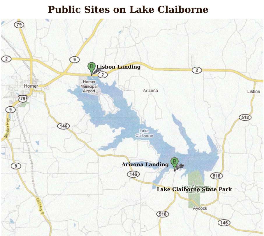
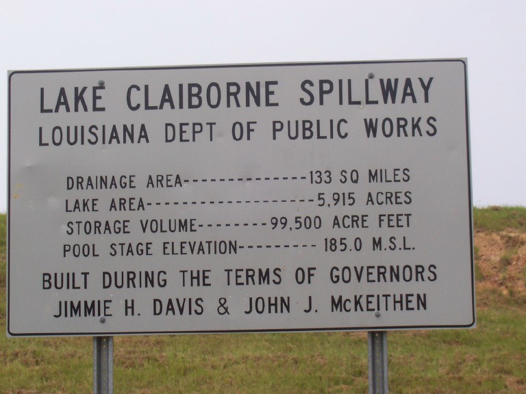
LAKE CLAIBORNE
Location in Claiborne P. Sec. B, Township 20, Range 5W
LC Dam DOTD ID#:14-00011
| FEATURE |
DESCRIPTION |
COMMENTS |
| Purpose |
Recreation,
Water Supply Reservoir |
|
| Year
Completed |
1966 |
|
| Lake
Length |
8.5
miles |
|
| Shoreline
Length |
~
40 miles |
~30
miles improved in 1996 |
| Lake
Area at Pool Stage |
6300
acres |
|
| Drainage
Area |
130
sq. miles (83,200 acres) |
|
| Lake
Depth |
Max.:
35 feet; Average: 15.7 feet |
2.5
miles upstream from dam: 30 feet;5 miles upstream
from dam: 20 feet |
| Lake
Volume |
99,500
acre feet of water |
|
| Length
of Dam |
5110
feet |
|
| Height
of Dam |
202'
MSL or 17' above pool stage |
Structural
height = 72' |
| Spillway
circular drop inlet |
top:
62' diameter (200' crest length) ;opening at
bottom: 30';3 9.5' x 14' concrete outlet conduits |
only
one of its type in LA |
| Drawdown
Structure |
2
8' x 8' sluice gates |
invert
elevation: 151.2' |
| Pool
Stage |
185'
MSL |
spillway
crest elevation |
| Surcharge
Elevation for |
*Design
Storm 198' MSL |
*Based
on actual 1933 storm in Cypress Bayou plus 35%
volume |
Surcharge
Height
(in parentheses Lake Height in Feet MSL above
Pool Stage) |
Predicted
Storms
*10 year storm: 3.5' (188.5');
*25 year storm: 4.6' (189.6');
*100 year storm: 6.6' (191.6');
Actual 1991 storm: 7.2' (192.2' );
Design (max.) storm: 13' (198' ) |
|
| Rainfall/24
hrs. & Peak Discharge |
Design
storm: 15"
& 66,600 cfs
*100 Year storm: 10"
& 45,000 cfs
Actual 1991 storm: 12" |
*By
predictions, a 10 year storm has a 1 in 10 chance
in any year, etc. |
| Water
Level Drop |
Max:
2 feet |
|
Downstream
Water
Surface Elevation |
165.5' |
Well
below pool elevation, so no tailwater
effect on outflow |
| Dependable
Yield Water |
Max:
63,000,000 gallons per day |
Based
on the 38 months from 1953-57 |
| Hazard
Rating |
High |
can
cause costly destruction if dam fails |
MSL (Mean Sea Level) is 150' at base of Lake Claiborne
dam
Abbreviations: "Commission" refers to Claiborne
Parish Watershed District Commission
LDWF: Louisiana Department of Wildlife and
Fisheries
DOTD: Louisiana Department of Transportation and
Development
Historic Timeline: LAKE CLAIBORNE
Establishment
- 1957: Project conceived
- 1959: Study completed
- 1963: Project funded & construction
started
- 1965: Construction completed
- 1966: Clearing completed & gates closed in
the fall
- 1968: Water ran over spillway (May 17, 1968)
Major Improvements
-1982: Outfall Channel Critical Area Treatment
Flooding
- 1991 (April): Maximum flooding to date; 6.5'
above pool stage
- 1997: Twice reached levels 4' above pool stage
- 2009: Reached 3.5' above pool stage twice in a
short period of time in November
top
Lake Claiborne Dam and Adequacy of Spillway Lake
Claiborne Surcharge Reduction Study
Progress Toward Improving the Spillway
2002-2007 History of Contacts to Request
Federal Aid for the Recoinnaissance Study--
Many contacts were made with Senators Landrieu and
Breaux's offices and offers were made to request
inclusion of the reconnaissance study in the federal
budget. In 2007, Rep. McCrery's office announced that a
request would again be made. Below is excerpt of a
CPWD letter dated Sept. 30, 2002 to Senator Landrieu
(Senate Appropriations Committee) acknowledging her
promise to work to include in Federal budget funding for
a US Corps of Engineering Federal Reconnaissnace Study to
explore spillway designs to relieve flooding
problem. Watershed Commissioners followed up on
this course of action. For several years, budget
requests were formally submitted in March.
RE: Landrieu Project No. 111099 attn: Herman
Gesser, III, Projects Director Dear
Honorable Mary Landrieu, We appreciate your
assurance (in letter of September 12) that you will
advocate for inclusion in appropriations legislation of
funding to conduct a U.S. Army Corps of Engineers Federal
Reconnaissance Study to explore spillway designs to
reduce the 100-year storm surge for Lake Claiborne. We
understand that if inclusion in the Fiscal Year 2003
Energy and Water Appropriations Bill is not possible at
this late stage, you will continue to work for the
inclusion of our proposal in the Fiscal Year 2004
legislation. We will appreciate your keeping us
informed about developments concerning our request. ...'
top

CORNEY LAKE
Location in Claiborne P. Sec. B, Township 20, Range 5W
LC Dam DOTD ID#:14-00011
| FEATURE |
DESCRIPTION |
COMMENTS |
| Purpose |
|
|
| Year
Completed |
1937 |
Spillway
Rehabilitation In 1995 |
| Lake
Length |
|
|
| Shoreline
Length |
|
|
| Lake
Area at Pool Stage |
2350
acres |
|
| Drainage
Area |
443
sq. miles (?) |
|
| Lake
Depth |
6
feet |
feet
of water at pool stage |
| Lake
Volume |
14,000
acre |
|
| Length
of Dam |
3900
feet |
|
| Height
of Dam |
124.5'
MSL or 9.5' above pool stage |
Structural
height = 28' |
| Spillway
Length |
680
feet |
|
| Drawdown
Structure |
|
|
| Pool
Stage |
115'
MSL |
|
| Elevation
for Design Storm |
123.66'
MSL
Rainfall/24 hrs.
Design storm: 15"] |
*Based
on actual 1933 storm in Cypress Bayou plus 35%
volume |
| Surcharge
Height |
Design
storm: 8.66' |
Feet
above Pool Stage |
| Rainfall/24
hrs. |
Design
storm: 15" |
*By
predictions, a design storm is the worst
predicted |
| Water
Level Drop |
|
|
Downstream
Water
Surface Elevation |
|
|
| Dependable
Yield Water |
|
|
| Hazard
Rating |
|
|
MSL (Mean Sea Level) is 150' at base of Lake Claiborne
dam
Abbreviations: "Commission" refers to Claiborne
Parish Watershed District Commission
LDWF: Louisiana Department of Wildlife and
Fisheries
DOTD: Louisiana Department of Transportation and
Development
top
FLOODING:
Important Considerations:
- The
design of Lake Claiborne's spillway is such that
opening the gates will not control a rising lake
level when the rising level threatens to affect
lakefront property. Lake Claiborne is not a flood
control lake. The gates are designed to lower the
lake for lake maintenance only. See DOTD material
in Watershed District files for more information.
- Lakeshore
residents are advised to build with the flood
potential in mind. DOTD has a standing request to
the Watershed District to issue this advice on an
ongoing basis.
Engineers have calculated the expected rise in Lake
Claiborne water level during a storm for different
scenarios (many assumptions are made, so the calculations
yield estimates only):
- "Design
storm" discharge (based on 15" rainfall
in 24 hours, considered the worst storm possible)
would result in a rise in the water level of Lake
Claiborne 13 feet above the lake's normal pool
level.
- "100
year storm" discharge (10" rainfall in
24 hours) would result in a 6.3 feet rise in lake
level.
- "25
year storm" discharge would result in a 4.6
feet rise in lake level.
- "10
year storm" discharge would result in a 3.5
feet rise in lake level.
- Discharge
from an actual storm in 1991 resulted in a 7.2
feet rise in the level of Lake Claiborne above
pool level.'
(see Lake
Claiborne Surcharge Reduction Study)
At the northern end of the dam, there is an all
earthen structure (without impervious core) lower than
the dam's height, designed as an emergency spillway in
the event of the "probable maximum
flood." This spillway would provide water
outlet only when the lake level rises to approximately 11
feet above normal pool level. (see Lake
Claiborne Surcharge Reduction Study)
top
LAKE DRAWDOWNS
Drawdown
of Lake Claiborne, 2004 Presentation
| Year |
Depth
(feet) |
Rate
("/day) |
Time
Period |
Purpose |
Comments |
| 1971 |
5 |
4-6 |
Aug
2- Oct 15 |
Bank
stabilization; Erosion
control; LDWF
shoreline improvements |
Returned
to pool stage Mar. 10 |
| 1973 |
8
1/4 |
|
(Jan)
? |
|
Returned
to pool stage Apr. 25 |
| 1975 |
8 |
3 |
Aug
1- Jan 10 |
|
|
| 1980 |
8 |
4* |
Aug
15-
Jan 1(plan) |
|
*Broken
pin, so level dropped 12' before repair,
then more with drought; returned to pool
12/16/82 |
| 1982 |
5 |
|
Aug
1- |
Shoreline
repair; Decrease tannic acid from
decaying timber |
Some
preferred post-Labor Day drawdown; LDWF
advised bass
spawning can start Feb 15 |
| 1987(?)* |
|
|
|
|
*Information:
Commission's May minutes report
recommendation |
| 1990 |
4* |
|
Sep
5-Dec 7 |
|
*Commission
authorized optional increase at request of
shoreowners |
| 1991
(?)* |
|
|
Sep-Jan
1 |
|
*Information:
Commission's Apr minutes & 1998 study
reporting 3 1990 drawdowns |
| 1996 |
7
(optional
by plan) |
|
Sep- |
|
Shoreline
repairs (but some planning was confused by
optional depth of drawdown) Closed gates after 5'
drop (rainfall considerations); Commission
established regular 3 year drawdowns*
(Newspaper:‘usual 5 year interval')
*rescinded Oct 1996 |
| 1998 |
7
(plan only) |
|
|
Shoreline
property repairs after severe weather |
Canceled.
Lake residents surveyed: 232 for drawdown
& 211 against. Public meeting:
90 for, 217 against. |
| 1999 |
4 |
3-4 |
Sep
6 -Jan 17 |
Expose
stumps for buoy placement |
Complaint:
"short drawdown" causes erosion
under retainer walls |
| 2004 |
7'
drawdown was planned |
3-4"/day
was planned, but 5+"/day was drawndown for
the first few days |
Sep
4-Jan 31 was scheduled (Gates
were closed, though, on Jan 7 because the lake
level was lower than planned.)
|
Shoreline,
Buoy, & Lisbon Landing, repairs; tree
clearing on dam |
WLF
did not approve Watershed District's request for
regular, every 8 years, drawdowns for shoreline
repairs. There
were many problems with this drawdown.
Downstream landowners complained of flooding
(unusually heavy Oct. rains), so DOTD slowed rate
of water release; contractors complained they
could not complete deep water pier renovations,
so rate was increased; end date was extended to
Jan. 31 (vs Jan 15 planned) but proved to be
unnecessary because gates were closed on Jan. 7
due to excessive (~9 feet) lake lowering (faulty
meter). |
| 2007 |
3'
drawdown |
|
Scheduled
Sept. 17 (after duck hunting) |
GPS
positioning of pole channel markers |
|
Other information on Drawdowns:
- Drawdowns are used to promote aquatic habitats and
fish populations, but an untimely or excessive one can
interfere with the same. LDWF suggested Labor
Day to Jan. 15 as the ideal time and a 5' to 6' level
drop to satisfy public demand while not compromising
aquatic life (Commission's March 8 minutes)
- DOTD operates drawdowns deferring to LDWF for timing
to protect aquatic life; Commission may seek concurrence
of LDWF before requesting DOTD or may ask LDWF to request
DOTD.
- In 1997, LDWF recommend against lowering Lake
Claiborne for flood control on the grounds that the
control gates were not designed for this purpose (April
1997 Commission minutes);
- Commission considered prerelease (winter lake
lowering in anticipation of spring flooding). LDWF
reported that such action might harm largemouth bass and
possibly crappie reproduction. (1998 minutes)
- RESOLUTION FOR ROUTINE DRAWDOWNS OF LAKE CLAIBORNE
June
20 2002 Meeting Minutes recording Draft Resolution for
Routine Drawdowns of Lake Claiborne and discussion of the
resolution.
Adopted by Claiborne Parish Watershed District
Commission on June 20, 2002
WHEREAS, the Commission is charged by state statute
with the care, management, and control of Lake Claiborne
with the purpose, among others, to prevent destruction of
property; and is also charged by state statute to
cooperate with state agencies in the maintenance and
operation of Lake Claiborne dam; and
WHEREAS, over the years the Commission has received
citizen complaints that drawdowns for routine lakeshore
property maintenance are arbitrarily scheduled and often
conducted without sufficient notice to arrange for
repairs, and
WHEREAS, a seven foot drawdown, at a rate of 3"
to 4" per 24 hours, initiated the week after Labor
Day and ending by January 15, has been successfully
accomplished in the past and is considered reasonable,
and
WHEREAS, the Department of Transportation &
Development controls the gates of Lake Claiborne spillway
and the department, before initiating a drawdown, seeks
the assurance of the Department of Wildlife and Fisheries
that aquatic life will not be seriously harmed, and
WHEREAS, the Department of Wildlife and Fisheries has
advised drawdowns no more frequently than every eight
years, except for urgent reasons, and
WHEREAS, Department of Transportation and Development
engineers have stated that Lake Claiborne dam was
designed to allow for drawdowns for shoreline repair and
have written, in June 2002, that the gates of Lake
Claiborne dam are "in excellent condition and could
be utilized without mishap for a drawdown,"
and WHEREAS, the last regular drawdown was six
years ago with a short drawdown three years ago,
NOW THEREFORE BE IT RESOLVED, that the Commission
issue a written request to the
Department of Wildlife and Fisheries with the
following recommendations:
1) that a drawdown of Lake Claiborne be
scheduled every eight years for the purpose, among
others, of routine maintenance of property along the lake
shoreline,
2) that for such regularly scheduled drawdowns,
the lake be lowered a maximum seven feet below pool stage
at a rate of 3" to 4" per 24 hours, with
emphasis on the word ‘maximum' to state that the
lake should be lowered only to the level that would meet
goals and be consistent with Dept. Of Wildlife and
Fisheries requirements,
3) that such drawdowns be initiated during the
week after Labor Day and ended before January 15,
4) that in the event of an interval drawdown
conducted for urgent reasons, such as aquatic life stress
or widespread property damage after a major storm, the
every eight year schedule should be resumed eight years
after that urgent drawdown,
5) that any commission request for an urgent
drawdown have the consent of six of the seven
commissioners, and
6) that scheduled drawdowns begin in the fall of
the year 2004, which is eight years after the last full
drawdown in 1996, assuming agreement of Dept. Of Wildlife
and Fisheries with respect to the impact on aquatic life,
and of the Department of Transportation and Development
with respect to the condition and operability of the
gates for a drawdown at the time.
Note: Discussion at the June, 2002,
meeting included the following observations: 1) based
upon one Lake Claiborne drawdown experience, with every
drawdown there is risk, however small, of operation
failure with devastating sequelae; 2) (from DWF's James
Seales) the effect of Lake Claiborne drawdowns on the
fish population has been difficult to determine,
possibly, in part, because drawdowns have been relatively
frequent; 3) (from WLF's James Seales) a drawdown
of 5 or 6 feet generally would not be expected to
seriously compromise aquatic life but that a 7 foot
drawdown would begin to expose important lake bottom.
As of 2007, Dept. of Wildlife and Fisheries has
declined to act upon the request made through the above
resolution.
top
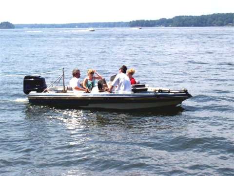
FISHING
Historic Timetable and Fishing on Lake Claiborne
1974: Lake Claiborne was selected as a Louisiana
impoundment to be stocked with striped bass
1987 (May): LDWF netting yielded mostly hybrids,
then German carp, then large channel
catfish
1988: Commission agreed that striped bass be
returned to lake, at LDWF's request
$4000 for channel catfish
LDWF: Lake Claiborne was chosen for Intensive Lake
Management 1/89-1/90
100,000 disease-free catfish were stocked
1992: Accepted stripers
Purchased 100,000 catfish fingerlings
1993: Stocked stripers
Commercial netting forbidden because:
1) channel catfish are
expensive, difficult to raise, & susceptible to
netting and
2) Commission had spent
$29,225 stocking 412,000 channel catfish
1997: LDWF won't stock striped bass, including
hybrids, at Commission's request
Later, at citizen request to reconsider prohibition,
Commission agreed to return
to LDWF all considerations regarding stocking of
plants and animals in Lake Claiborne
2002: Feb. 4 Watershed Commission stocked 68,000
catfish fingerlings-LDWF
recommendation
May 3, LDWF stocked the lake with 70,000 Florida bass
fingerlings
May 6, LDWF stocked the lake with 65,000 (or 68,000?)
Hybrid striped bass fingerlings
2007: May 4, LDWF stocked the lake with approximately
69,984 Florida Largemouth Bass fingerlings
May
17, LDWF stocked the lake with approximately 68,608
Hybrid Striped Bass fingerlings
Fall
-- LDWF stocked the lake with Channel Catfish fingerlings
2009: LDWF
stocked the lake with Channel Catfish fingerlings
(photos)
top
Studies of Fishing on Lake Claiborne
1) Pezold, Frank and Kittler, Cynthia. An Assessment
of Water Quality, Zooplankton, and Fish Production in
Lake Claiborne, La.:A Final Report Submitted to the Lake
Claiborne Watershed District Commission." Dept. Of
Biology, Northeast Louisiana University and Grambling
State Universities. 1998
2) Louisiana Dept. Of Public Works, Lorris Wimberly,
Dir. Water Resources Development Investigation:
Claiborne Parish. Feb. 1959
3) Louisiana Department of Transportation and
Development. Lake Claiborne Surcharge Reduction
Preliminary Feasibility Study. August, 1998
4) Bertrand, Alvin L. Project Dir. Middle Fork
Bayou D'Arbonne Reservoir Project: A Feasibility and
Social Impact Study , Bulletin 687. Louisiana State
Univ. Agricultural Experiment Station. Aug. 1975
5) Pezold Frank, Hill Anna, and Kittler,
Cynthia. Increasing Largemouth Bass Production in
an Oligotrophic Reservoir. Northeast Louisiana
Univ. & Grambling State Univ. 1997
Penzold and Kittler Study: Summary (Reference
Above: #1'Studies of Fishing on Lake Claiborne')
In 1998, the Claiborne Parish Watershed Distric
Commission requested a study (1-Pezold: see
‘Studies' below) of water quality and fish
production in Lake Claiborne. Findings of that
study and other from sources are presented here.
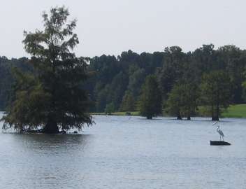
Lake Claiborne, like most reservoirs associated with
small watersheds on Gulf coastal plains is an
oligotrophic lake: low alkalinity, slightly acidic soft
water, soils nutrient poor & low in calcium.
- low calcium negatively affects alkalinity, a
measure of buffering capacity, i.e. capacity to maintain
a constant pH of lake water (e.g. in past, heavy rains
have lowered pH on Lake Claiborne)
- calcium is a necessary element for aquatic
life; low calcium is an index of low nutrients in
general
Fish production in Lake Claiborne , esp. of large
mouthed bass, is relatively low .
- total fish production averages 131.6
lb./acre2 (highly variable by year and site)
- largemouth bass production averages 9.75
lb./acre (rotenone assays 1970-1989, LDWF data)
- all life stages present, including larval,
i.e. well- established in Lake Claiborne
- low productivity at all life stages because
of:
1) water quality of the lake
2) prefer as prey
structure-oriented forage fish, not shad, an open-water
fish that makes up 78% of adult fish biomass (Lake
Claiborne, 1994)
3) shad consume nutrients otherwise
available for largemouth bass
- hybrid striped bass were introduced to use
nutrients lost to largemouth bass
Authors of the study recommended increasing lake
fertility by manipulating lake water levels, planting a
cover crop on exposed lake bottom. Dropping the
lake level allows new vegetation on the exposed lake bed,
taking up nutrients locked in the sediment.
Reflooding releases nutrients from decaying
vegetation. Infrequent but extreme drawdowns are
usually recommended (authors suggest annual or biannual),
because more frequent drawdowns can decrease forage for
certain species and leave a fluctuating zone unsuitable
to all species. Small annual drawdowns (20% of lake
substrate) have been used successfully. Seasonal
timing is most important. Low and fluctuating water
levels in spring and summer compromise near-shore
spawners (shiners, white crappies -- perch), vegetation
spawners, and young-of-year, e.g. bass.
top
Commercial Fishing on Lake
Claiborne and Permitting Commercial Establishments
LEGISLATION INTRODUCED BY REP.
GALLOT, REPRESENTING CLAIBORNE PARISH, HB NO. 975,
amended and reenacted R.S. 38:2874, relative to the
Claiborne Parish Watershed District; to authorize the
Wildlife and Fisheries Commission to regulate the
commercial and recreational use of nets and traps on Lake
Claiborne; and to provide for related matters as provided
by Article III, Section 13 of the Constitution of
Louisiana.
R.S. 38:§2874. Management of fish; commercial
establishments
A. The Wildlife and Fisheries
Commission may regulate, restrict, or prohibit the
recreational or commercial use of hoop nets, gill nets,
trammel nets, strike nets, seines, wire nets, slat traps,
and wire traps on Lake Claiborne.
B.(1) The board of commissioners
of the Claiborne Parish Watershed District shall have
authority to establish and cause to be enforced rules and
regulations pertaining to all commercial establishments
which may be constructed for the purpose of
commercializing and making commercial use of the
facilities provided by the said lake or its watershed; to
license and permit such establishments and to levy and
collect a fee, to be fixed by the commission, for the
privilege of making commercial use of the facilities of
said lake, or to refuse to license or permit any
commercial establishment to use the facilities provided
by said lake.
(2) The rules and regulations
established and promulgated by the board of commissioners
of the Claiborne Parish Watershed District shall provide
penalties for any such commercial establishment operating
without a permit or license, and such rules and
regulations shall be enforced by the sheriff and
violations thereof prosecuted by the district attorney of
the judicial district within which the watershed district
is situated, as hereinabove provided.
Added by Acts 1966, No. 299, §14; Acts
1993, No. 830, §2; Acts 2004, No. 541, §1.
top
PIPELINE CROSSING LAKE CLAIBORNE
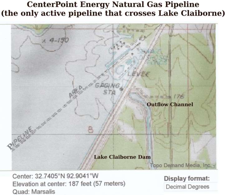
Marking
Natural Gas Pipeline Crossing Lake Claiborne
top
Contact:
Claiborne Parish Watershed District Commission
Mailing Address: P.O. Box 266, Homer, LA 71040
Physical Address: 507 W. Main, Homer, LA 71040 (Police
Jury Office Complex, Courthouse Square, Homer)
Hours: Phone Calls are answered M-F 7:30am-4:30pm Call to
request a visit with a member of the commission.
Phone: (318) 927-5161
Email: cpwatershed@yahoo.com
Clerk: Jo Anne Horner
top
|
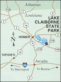
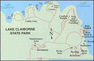
Lake Claiborne State Park
Email: lakeclaiborne@crt.state.la.us
Lake
Claiborne State Park Economic Analysis 2004-2005
Lake
Claiborne State Park Adds $1.6 Million To Local Economy
In 1998 By Susan T. Herring,
Editor, The Guardian-Journal (Parish site)
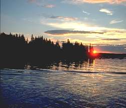
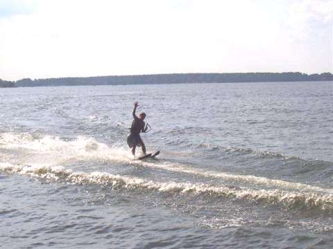
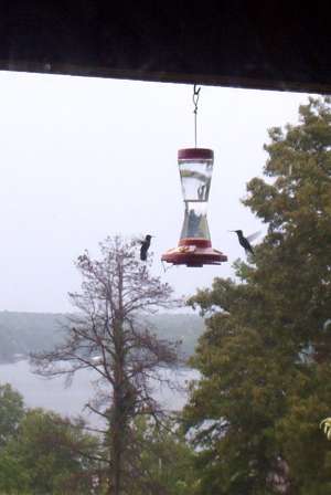
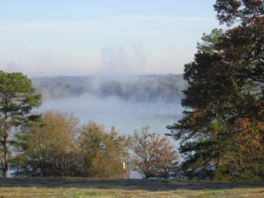
Photos of Lake Claiborne
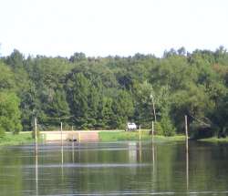
Photos of Corney Lake
|